
The St. Marys Trail is open to the public. However, due to the crowds that have been using the trail, the Forest Service would like to take some pressure off the trailhead. An alternate route is the Mine Bank Trail.
To get to the Mine Bank Trail, head to milepost 23 near the Fork Mountain Overlook on the Blue Ridge Parkway. There is a small parking area on the west side of the Parkway. Follow the Mine Bank Trail to the St. Marys Trail and turn left. There is some camping throughout this area. At the junction with the Falls Trail turn right and cross the creek. The falls is about 0.6 miles. The total out and back is just over 9 miles and it makes for a good overnight backpack.
Also, as always group size is limited to ten in any Wilderness area and there is no camping with 500 feet of the stream and there is no camping at the falls. A violation can result in a ticket.
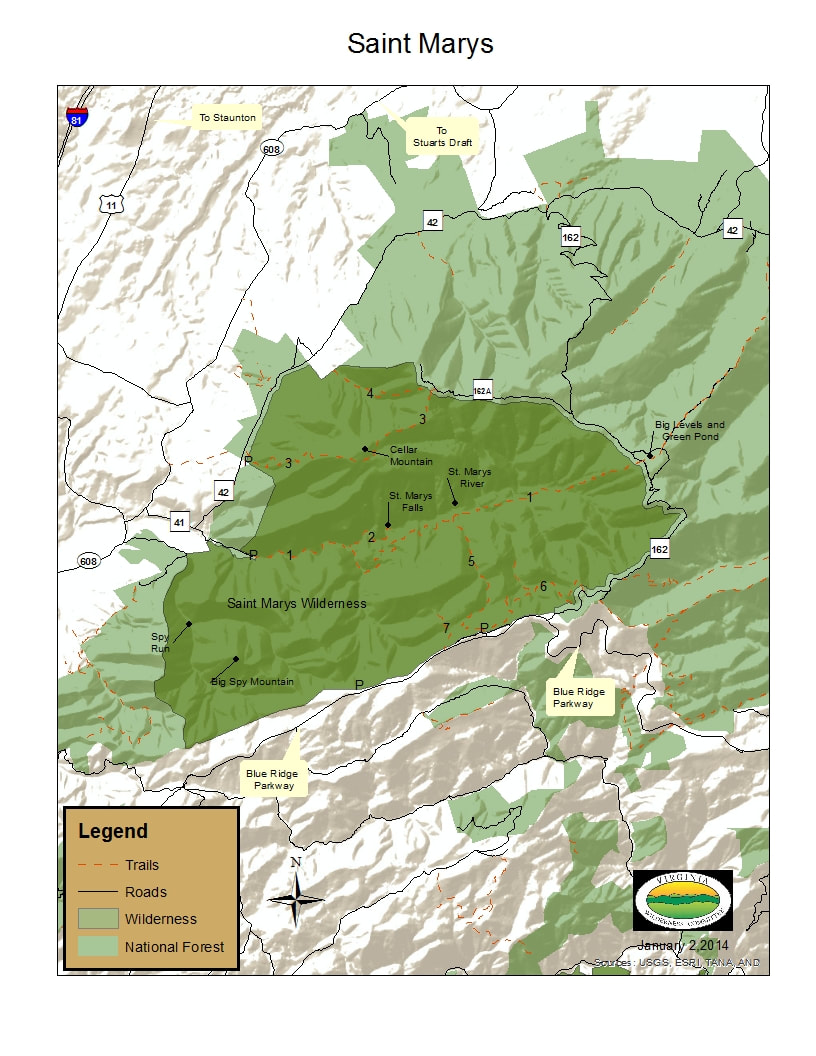
The map of the Saint Mary’s Wilderness has a list of numbered trails. They are as follows:
1) Saint Mary’s Trail, 7.0 miles (one way)
2) Saint Mary’s Falls Trail, 0.5 miles (one way)
3) Cellar Mountain Trail, 2.9 miles (one way)
4) Cold Springs Trail, 1.3 miles (one way
5) Mine Bank Trail, 2.0 miles (one way)
6) Bald Mountain Overlook Trail, 2.5 miles (one way)
7) Mine Bank Mountain Trail, 0.5 miles (one way)
Many of these trails, although one way, can be combined with FDR 162 and 162-A to create loop opportunities.
 RSS Feed