Beech Lick Knob Proposed Wilderness
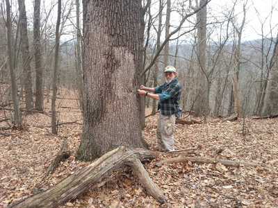 Ralph Bolgiano measures 38" diameter black oak. © Chris Bolgiano
Approximate Size: 6,200 acres
Location: Rockingham County, Virginia in the North River District
Topos: Fulks Run, Cow Knob
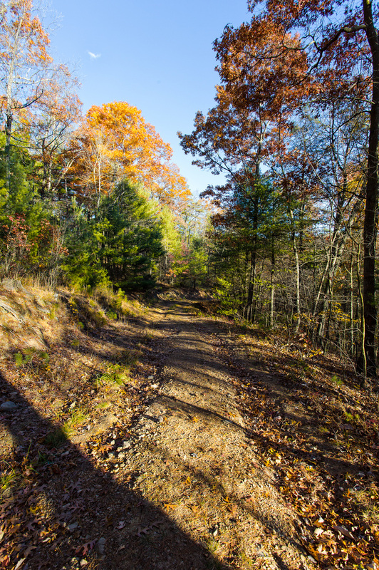
Beech Lick Knob is one of the largest roadless tracts on the GWNF that the Forest Service failed to include in its official inventory of roadless areas. Elevations here range from 1650 to 3150 feet, with a great diversity of topography. Drainages include Sumac, Lairs, Root, Stony, Martin Lick, Marshall, and Carr Runs. Ridges and peaks include Clover Lick, Beech Lick, White Grass, and Wetzel Knobs; Carr, Little, and Snake Hollow Mountains; and First, Middle, and Third Points.
A very large area of "semi-primitive" acreage occurs here where visitors can experience solitude and serenity. There are 4241 acres of possible old growth.
Blue Hole campground is near the northeastern boundary of the area. FR 302 (Grove Hollow Road), which goes around behind Blue Hole provides access to the northern side of Beech Lick Knob Wilderness. FR 232 (German River Road) provides access to the western side, and SR 819 and FR 235 provide access to the eastern side.
Our proposed Beech Lick Knob Wilderness Area is much smaller than the "potential wilderness area" boundary defined by the Forest Service, to accomodate trail and other access and mineral issues. The Beech Lick Knob western boundary is the Carr Mountain Trail. This trail, which is a critical link in the Great Eastern Trail, is open to hikers, mountain bikers and horseback riders. FDR 302 (Grove Hollow Road) will remain outside the wilderness boundary.
The proposed wilderness does not have any privately-owned mineral rights. The wilderness boundary has been drawn to exclude portions of Beech Lick Knob historically managed for timber
All private land-owner rights and access will be maintained.
All roads currently open to the public will remain open for access.
Location: Rockingham County, Virginia in the North River District
Topos: Fulks Run, Cow Knob
Beech Lick Knob is one of the largest roadless tracts on the GWNF that the Forest Service failed to include in its official inventory of roadless areas. Elevations here range from 1650 to 3150 feet, with a great diversity of topography. Drainages include Sumac, Lairs, Root, Stony, Martin Lick, Marshall, and Carr Runs. Ridges and peaks include Clover Lick, Beech Lick, White Grass, and Wetzel Knobs; Carr, Little, and Snake Hollow Mountains; and First, Middle, and Third Points.
A very large area of "semi-primitive" acreage occurs here where visitors can experience solitude and serenity. There are 4241 acres of possible old growth.
Blue Hole campground is near the northeastern boundary of the area. FR 302 (Grove Hollow Road), which goes around behind Blue Hole provides access to the northern side of Beech Lick Knob Wilderness. FR 232 (German River Road) provides access to the western side, and SR 819 and FR 235 provide access to the eastern side.
Our proposed Beech Lick Knob Wilderness Area is much smaller than the "potential wilderness area" boundary defined by the Forest Service, to accomodate trail and other access and mineral issues. The Beech Lick Knob western boundary is the Carr Mountain Trail. This trail, which is a critical link in the Great Eastern Trail, is open to hikers, mountain bikers and horseback riders. FDR 302 (Grove Hollow Road) will remain outside the wilderness boundary.
The proposed wilderness does not have any privately-owned mineral rights. The wilderness boundary has been drawn to exclude portions of Beech Lick Knob historically managed for timber
All private land-owner rights and access will be maintained.
All roads currently open to the public will remain open for access.
|
| ||||