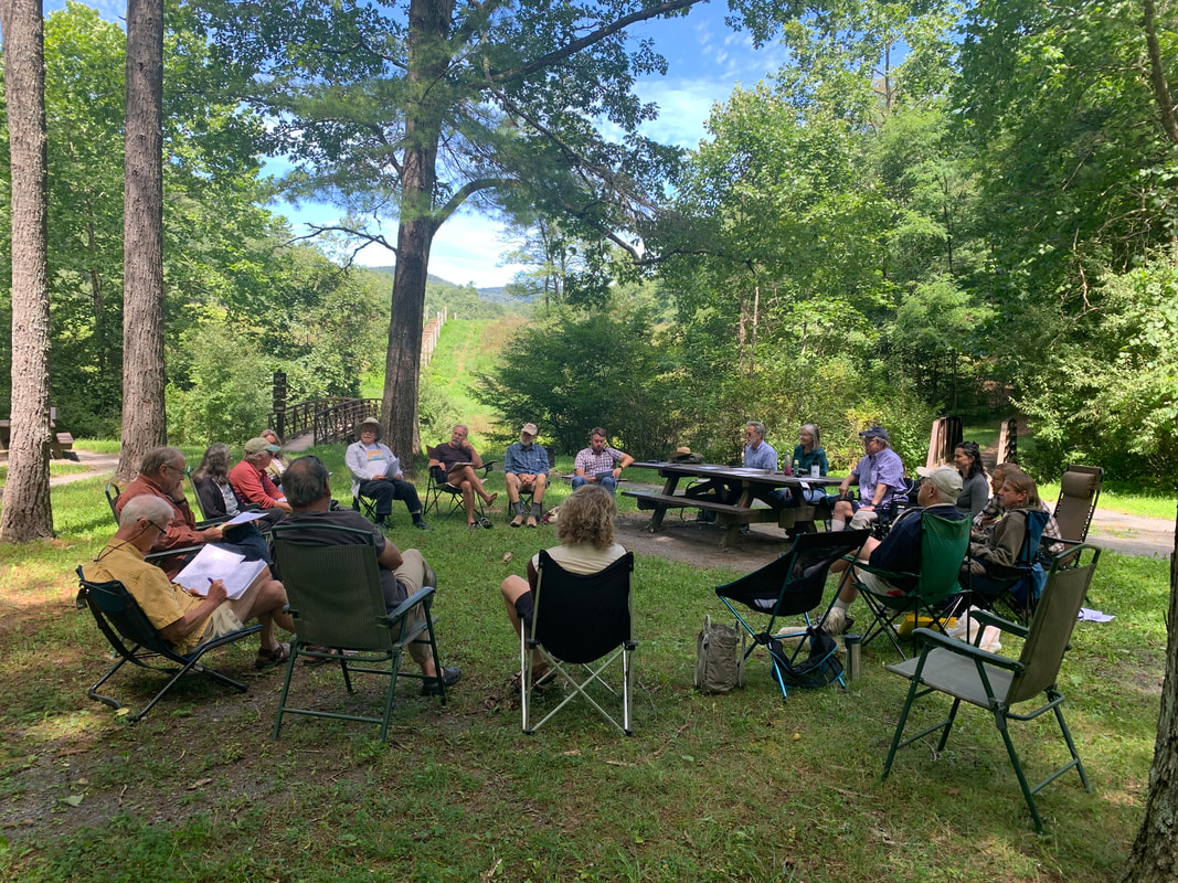
Virginia Wilderness Committee
  • Home
  • About
    • Contact us
    • History of the VWC
  • Campaigns
    • Jefferson National Forest
    • GW National Forest >
      • Lower Cowpasture Project >
        • Rough Mountain Addition
        • Rich Hole Addition
      • Shenandoah Mountain >
        • Bald Ridge Wilderness Addition
        • Lynn Hollow Wilderness
        • Little River Wilderness
        • Skidmore Fork Wilderness
      • Beech Lick Knob
      • Laurel Fork
      • VWC's Collaboration with Forest Stakeholders
  • News
    • Newsletters
    • Press Releases
    • Dominion Pipeline
  • FAQ
    • Steps in the Passage of a Wilderness Bill
    • Brochures
    • Hikes
  • GW/Jeff NF
    • George Washington National Forest
    • Jefferson National Forest
  • Donate/Join

Trail Work Opportunity, March 25, Rich Hole Wilderness

3/20/2023

0 Comments

 
Picture
0 Comments

Senators Kaine & Warner Reintroduce Bill to Protect Wilderness in Bath County

3/9/2023

0 Comments

 
MARCH 09 2023
​
Warner & Kaine Reintroduce Bill to Protect Wilderness in Bath County | 2023-03-09 (senate.gov)
WASHINGTON, D.C. – Today, U.S. Senators Mark R. Warner and Tim Kaine reintroduced the Virginia Wilderness Additions Act, legislation that would add a total of 5,600 acres to the existing Rough Mountain and Rich Hole wilderness areas within the George Washington National Forest in Bath County, Virginia.
“It’s crucial that we preserve Virginia’s natural treasures, which are essential to the economy and way of life in communities across the Commonwealth,” the senators said. “We’re thankful for the input, advice, and good-faith work by local officials and conservationists who have come together over the years to create this plan to better preserve land within the George Washington National Forest. We look forward to continuing to work together to include this legislation in this year’s Farm Bill so we can get it across the finish line.”
A wilderness designation is the highest level of protection for public land under federal law. These additions were recommended by the U.S. Forest Service in 2014 and endorsed by members of the George Washington National Forest Stakeholder Collaborative, a group of forest users that started work together over a decade ago to agree on acceptable locations in the George Washington National Forest for wilderness, timber harvest, trails, and other uses.  
The Farm Bill is a multiyear government funding bill for programs pertaining to conservation, crops, and nutrition, among others. Congress is expected to pass a Farm Bill in 2023.
In each of the last three Congresses, the legislation has passed through one chamber, either the Senate or the House of Representatives, but has yet to pass through the both chambers during a single session. In January 2020, as part of the 116th Congress, the Senate passed Warner and Kaine’s bill, but the legislation was not taken up in the U.S. House of Representatives. In the 117th Congress, the House passed a version of this bill as part of broader package of environmental bills, but it was not taken up in the Senate.
Full text of the legislation is available here.

0 Comments

Need speakers?

2/1/2023

0 Comments

 
Interested in Wilderness in Virginia? We are happy to come out and talk about what Wilderness is, where to find it in Virginia, and all we do to protect it. Email info@vawilderness.org for more information.
0 Comments

Trail Work Opportunity February 11

1/30/2023

0 Comments

 
Our friends at SAWS will be hosting another volunteer day in Rich Hole Wilderness, Alleghany County on February 11 to finish clearing the trail with crosscut saws. No experience necessary! If you’re interested, please contact Eric Giebelstein EricGiebelstein@wildernessstewards.org for more information and to sign up.
0 Comments

Upcoming Wilderness Trail Work Opportunity

1/19/2023

0 Comments

 
​Mark your calendars! Join SAWS for a volunteer work day in Rich Hole Wilderness, just outside of Lexington, VA on Saturday, January 21st at 9 am. We’ll be working on clearing some big downed trees from the with crosscut saws. Email Eric Giebelstein EricGiebelstein@wildernessstewards.org for more information and to sign up today!
Picture
0 Comments

VNPS Selects the Purchase of Mineral Rights as Annual Fundraiser

1/19/2023

0 Comments

 
We are delighted to announce that the Virginia Native Plant Society has selected the work we are doing to purchase the mineral rights under proposed Wilderness within the Shenandoah Mountain National Scenic Area as their annual fundraiser. We think permanently protecting these special places as Wilderness is important and in order to do so it is necessary for us to obtain the mineral rights. Please make your donation to this worthy cause today!
Picture
View from Reddish Knob by Brad Striebig
From VNPS:
Our 2022 fundraiser is underway! Help us protect over 30,000 acres for the creation of Shenandoah National Scenic Area for future generations to enjoy!

This year VNPS will partner with the Virginia Wilderness Committee (VWC) and the Friends of Shenandoah Mountain (FSM) to help protect and preserve four key wilderness areas in the proposed Shenandoah Mountain National Scenic Area of Virginia.

Although the US Forest Service owns this land, private individuals and companies own the underground mineral rights and can develop and extract those minerals. As long as there is the possibility of development and mining, the Forest Service will not protect these lands by designating them as a National Scenic Area or Wilderness Area.
We hope to help VWC and FSM with our financial assistance to acquire mineral rights from the current owners and transfer those rights to the Forest Service. They have already had success in acquiring mineral rights in these areas and need our help to continue identifying mineral rights ownership and to purchase the rights for four tracts that have been identified.

​https://vnps.org/vwcfund/
0 Comments

WMRA covers Shenandoah Mountain Biodiversity with VWC Vice President and EMU professor, Steve Johnson and VWC board member and FOSM co-chair, Lynn Cameron

10/28/2022

0 Comments

 
A local conservation photography class has been documenting biodiversity on Shenandoah Mountain this semester. WMRA's Randi B. Hagi reports.

​On a Wednesday afternoon in October, I caravanned westward with two cars full of photography students – passing Reddish Knob and parking about an hour's drive into the mountains.

[sounds of chatting, car doors closing, group walking]

To read the rest, click on the link below.
https://www.wmra.org/2022-10-26/photography-class-documents-shenandoah-mountain-flora-and-fauna
0 Comments

2022 VWC Annual Meeting

9/30/2022

0 Comments

 
In mid-August, members of VWC gathered at Braley Pond for our Annual Meeting. We discussed current projects of purchasing mineral rights, designating rural historic areas, strategizing for new recreation plans, identifying mountain treasures, and initiating historical markers. We also celebrated the two bills which are currently in congress awaiting traction. Most importantly, for the coming year, the Nomination Committee again presented John Hutchinson as president, Steve Johnson as vice president, Ron Stoltzfus as treasurer, and Tom Engle as secretary. VWC members unanimously approved the Committee’s slate of nominations. We all expressed appreciation to these officers for their continued service and are thankful to be guided by this great group of Wilderness-loving folks.
​
To learn more about our board members, please click here.
Picture
0 Comments

Protecting Appalachian Forests:  Decades of Effort

9/19/2022

0 Comments

 
By John Hutchinson •
Contributing Writer ALLEGHENY HIGHLANDS --

​Driving into the Allegheny Highlands or taking a walk in your back yard or field, do you ever glory in the splendor of the forests peering back at you? I find it hard not to. The vast majority of our region (four-fifths) is blanketed by forest; about half of that is publicly owned. I also wonder how our mountains got this way and if the owners, public and private, will let them stay so splendid. You may be surprised to know only about half of the forests around here are publicly owned, counting Douthat State Park, Highland Wildlife Management Area, and the George Washington National Forest. Virginia’s total land area is 27.4 million acres — 58.7 percent of which is forested, according to the results of the latest forest inventory completed in 2016. In Alleghany County, there are 123,209 public acres (52 percent) and 112,111 are privately owned (48 percent). In Bath, there 156,527 public acres (59 percent) and 111,026 private acres (41 percent). In Highland, there ae 109,653 public acres (47 percent) and 121,562 private acres (53 percent). So how did we get here?

Turn of the century
Go way back to 1907. That year, Congress required the Secretary of Agriculture to investigate the watersheds of Southern Appalachia and to report back:
• The area and natural conditions of those watersheds;
• The price at which the same could be purchased by the government;
• The advisability of the government buying and setting apart the same as national forest reserves for the purpose of conserving and regulating the water supply; and
• Stream flow in the interest of agriculture, water power, and navigation.
In 1911, Historian Oren F. Morten, in his “History of Highland County,” wrote, “In its wild state, Highland was an unbroken primeval forest, except that in some degree the river bottoms appear to have been natural meadows. The trees and shrubs present much variety and intermingled with them are many herbs and flowering plants.” Writing in The Recorder in 1932, forester W.A. Garber of the George Washington National Forest said about three-fourths, or 203,836 acres, of the total land area of Highland County, which is given as 270,080 acres, was timbered area or brush land. “These 203,836 acres have been classified as generally unsuitable for farming and agricultural use, due to unfavorable soil conditions, isolation from market facilities, steepness of slope and the resultant disadvantages of erosion and high expense of farming operations. Of the 203,836 acres shown as forest or potential forest land, 26,889 acres are embodied in the two national forests,” he said. So, by 1932, a tenth of Highland’s forestland was federally owned. Some saw the Southern Appalachian region was encountering destructive influences that, unchecked, would bring widespread devastation and ruin to many of the industries of the country. From 1900 until the 1920s, the forest cover was substantially reduced by heavy cutting. 2 Sawmills served by narrow-gauge, logging railroads spread throughout the southern mountains, even to the spruce forests of the highest elevations. Quite a few short line rail operators entered Highland County, largely from West Virginia, according. Alleghany and Bath each saw the development of mainline railroads, too, beginning in the 1850s. But by 1909, the lumber boom was declining and by the 1920s, most lumber companies had moved to other regions.

The national picture
Federal forest management dates back to 1876, when the U.S. Department of Agriculture began to assess the forests in the U.S. Fifteen years later, Congress passed the Forest Reserve Act of 1891, authorizing the President to designate “forest reserves” on public lands in the west. The Forest Reserves in the west were created out of public domain. In the east, though, very little public domain was left. Privately owned eastern land was often badly mishandled, leading to destroyed forests, soils, and watersheds. The western forest reserves fell under the Secretary of the Interior until 1905, when they were transferred to the Department of Agriculture’s new U.S. Forest Service. Gifford Pinchot, a noted conservationist, was its first chief, charged with caring for the renamed national forests. Congress commissioned two studies of the Appalachian Mountain region in 1905 and 1908 titled “The Southern Appalachian Forests” by H.B. Ayres and W.W Ashe, and “Report of the Secretary of Agriculture on the Southern Appalachian and White Mountain Watersheds,” by J. Wilson, in response to the devastation occurring in the region. Neither Highland nor Bath was within the northern limit of what the studies defined as “Southern Appalachian.” They were right next door, though, and the information collected is equally valuable to students of the Allegheny Highlands. Alleghany and Botetourt counties were both in the study area. For the purposes of this article, Allegheny Highlands includes Alleghany, Bath, and Highland counties. In response to all the devastation of the mountain forests, Congress passed the Weeks Act in 1911, giving the federal government authority to purchase the mostly wasted land to protect watersheds. The Shenandoah Purchase Unit, which includes the Shenandoah Mountain area in Augusta and Rockingham counties, was among the first land to be purchased. The newly purchased forest land became Shenandoah National Forest in 1917. The name was changed to George Washington National Forest in 1932 to avoid confusion with Shenandoah National Park to the east of the Valley. The Clarke-McNary Act of 1924 allowed the purchase of land for timber growing. It also broadened joint federal-state work in fire protection and forestry. In 1925, the Weeks Law Exchange Act eased consolidation of national forests by allowing the trade of land within forest boundaries for comparable land elsewhere.

Outside landowners 
In 1926, Congress passed a bill creating two parks in the Southern Appalachians — Shenandoah National Park and Great Smoky Mountains National Park. By the 1830s, these mountain valleys had become summer destinations for wealthy visitors escaping the heat. Some roadside stands evolved into hotels to accommodate these early tourists. Highland was, fortunately, not subject to the railroad and many of its influences. Between 1880 and 1900, investors from outside the region obtained most of the mineral and timber rights along the railroads. With the sale of these rights, many mountain farmers lost their agricultural livelihoods because clearcutting and mining reduced or destroyed the land’s agricultural productivity. As a result, many mountaineers became dependent on wage labor in the mines, resorts, and sawmills. Highland might have escaped this trend. The trend toward large ownership of land by outsiders continued, sometimes combining mining and lumbering interests in one company. Here again, Alleghany, Highland, and Bath had no substantial commercial coal, so mineral rights were of nominal value. A 1908 government report on the Southern Appalachians estimated 50 percent of its timberland was owned by large companies. Even after the activity of the late 19th century, large reserves remained nearly untouched. The 1902 report for the Secretary of Agriculture estimated 75 percent of the Southern Appalachians was still forested and 10 percent was still in virgin growth. In Highland, for instance, “The mountain ranges being almost wholly uncleared, they stand forth in primeval garb,” according to Morten. In 1911, Shenandoah and Jack mountains were both still “unbroken forest,” he said. Yet farm tenure statistics for 1900 back up the assertion of increased outside ownership. Most farms in the Southern Appalachian region (about two-thirds) were owner-operated; however, the second highest category of tenure, “share tenants,” indicates an increasing tendency toward absentee landlordism and tenancy in general. In some counties, as many as 30 percent of all farms had share tenancy. This situation was one reflection of the outsider investment and changes in landownership that began toward the end of the 19th century.

Whiskey and hillbillies
The “hillbilly” stereotype also was used to justify the widespread expropriation of mountain resources during the late 19th and early 20th centuries. John Fiske, a popular historian of the late 19th century, gave currency to the false idea that virtually all Southern mountaineers were descendants of whites transported to America as servants or criminals in early colonial times. Harry Caudill, another historian, claimed the mountaineer was "the illiterate son of illiterate ancestors," and of “debtors, thieves, and orphans who fled the cities of England.” Caudill was from eastern Kentucky. Morten seemed to agree, writing in his Alleghany County history, “Negro slaves were very few … Bound white servants, however, were numerous. Some of these were orphans or of illegitimate parentage. Whiskey became the virtually universal domestic industry of the Southern Appalachian region after the Civil War. Distilling was a natural outgrowth of corn production and relative isolation. Corn was the chief cash crop cultivated, but its transportation was difficult. Consequently, it was condensed into whiskey and marketed by the jug.  According to Morten, the 1840 census found Alleghany produced 70,828 bushels of corn — more than any other reported produce. That county had five distilleries that produced 3,400 gallons of whiskey that year alone. In 1900, eight years prior to his 1908 report to the Secretary of Agriculture, the author theorized, “The influences which (were) destroying the mountains were not then so far advanced. Virgin hardwood timber lands existed in large areas and could have been bought at from $1 to $5 per acre.” Within the preceding eight years, the country had seen the threshold of a hardwood timber famine. As a result, the prices of the virgin hardwood lands that remained advanced from 300 to 500 percent. The Southern Appalachian region was “advancing toward a condition of barrenness and sterility,” one historian said. Not just the loss of commercial timber, but “absolute barrenness and sterility-without timber, without undergrowth, without soil.” In 1908, President Roosevelt said, “The preservation of the forests, of the streams, and of the agricultural interests here described can be successfully accomplished only by the purchase and creation of a national forest reserve.” Morten agreed in 1911, writing, “Even the rockiest slopes of the Alleghenies can and should be a forest reserve.” In 1902, the National Hardwood Lumber Association and the National Lumber Manufacturer’s Association endorsed creating a Southern Appalachian forest reserve. They were joined by the American Forestry Association in 1905. The region’s forests, “through injudicious cutting, fires, clearing, and general misappropriation” were “moving toward a forestless, soilless condition,” Wilson said. “The time to begin is now. Every year that action is deferred the conditions are made worse and the cost of reclamation becomes commensurately greater,” Wilson wrote in 1908. As researchers pointed out, Appalachian streams were of enormous value to the nation. The water supply between the Ohio River and the Atlantic and Gulf coasts was affected by the heavy rainfall in these mountains. The 1911 Weeks Act helped solve two problems: it allowed private land to be purchased for a forest reserve, and it gave the government authority to acquire land specifically for the purpose of watershed protection. The same year, the Secretary of Agriculture issued a statement about the Weeks Act describing areas in the Southern Appalachians the government would first consider for purchase. Among the tracts were three that would eventually become part of the George Washington National Forest:
• Potomac Purchase Unit with 478,717 acres;
• Massanutten Mountain unit with 152,946 acres; and
• Natural Bridge unit, in the James River watershed, with 106,564 acres. Wilson had noted the original forest, with its characteristic conditions of shade, undergrowth, humus, and soil, was an effectual distributer of moisture. It had:
• A temperate and healthful climate;
• Grand and varied scenery;
• An ample supply of pure, cool water;
• Abundant water power;
• Mineral deposits of iron, copper, mica, talc, and other clays, building stone, etc.;
• Soils that were, in general, of good physical and chemical composition; and
• A vast extent of forest, principally hardwood, consisting of 137 species of trees.
Early conservationists had recognized the region for the distinctive factors which gave value to these mountains. “Because of its geological history and climate, the Southern Appalachian region possessed then and still possesses an abundance and great variety of trees, at least 130 species, perhaps the greatest variety of any temperate region in the world,” one noted. The first purchase under the Weeks Act on the GWNF was made in the Massanutten Purchase Unit in 1912. Just over 385 acres were bought from H.H. Rust of Page County. The Shenandoah Purchase Unit, which included the Shenandoah Mountain area in Augusta and Highland counties, was among the first land to be purchased for the new national forest, ultimately called the George Washington National Forest. But, man-set fires were rampant in the new national forests. So, the warden system was invented on the GWNF, then used throughout the eastern and southern forests. The forest service appointed one man in charge of a small area of the forest. This warden chose his crew of up to 20 other locals. When fires were spotted, the crews were quickly dispatched. By 1936, the supervisor of the GWNF figured his forest could eventually cut as much as 50 million board feet a year, despite the severe damage in the timber, a legacy of the years before federal ownership.

Need for protection
As these early federal documents noted, one of the main reasons to protect the land was for water. “Except along the crests of the ridges, one can hardly travel a quarter of a mile in an undisturbed portion of the forests without finding pure, cool water. These waters filter through moss and leaves a short distance, then follow the clean, stony bed of the brook down the mountains,” Ayers wrote for the USDA in 1905. On pastureland, however, whether wooded or cleared, “the trampling of cattle in the stream makes the water muddy and impure with earth and excrement, and reduces the filter of leaves, moss, and grass that holds back the impurities … Springs are frequent and many of them, especially in the wooded region, are pure, cool, and perpetual. In general, the streams from the forested portions of the mountains are suitable for all uses, but those from pastures and clearings, and especially those that follow roads, are impure,” Ayers said. “The present torrential discharge of the streams is due to the extent to which the forest has been cut away or damaged. … A mountain watershed denuded of its forest, with its surface hardened and baked by exposure, will discharge its swollen ruin into the streams so quickly that overwhelming floods will descend in wet seasons,” Wilson said. Of wildlife, Ayers wrote, “Trout have been dynamited, deer hunted, and turkey, quail, and pheasant slaughtered until game is nearly exterminated.” “Clearing virgin forests for farms is going on steadily from year to year to replace worn out, eroded, and abandoned lands. Always the movement is toward the higher lands, those lower down having finished their course,” Wilson agreed. Out of a total forested area of 7.2 million acres in the Southern Appalachians, 1 million was deemed to be “unlumbered and lightly culled” with the balance 6.3 million acres “lumbered and second growth” at that time “The original forest of this region, as indicated by the preserved remnants and by the accounts of the old settlers and early explorers, was wonderful in the extent, density, size, and quality of its timber trees, and the variety of their species,” Ayers said. Roosevelt himself noted, in 1902, “These are the heaviest and most beautiful hardwood forests of the continent. In them, species from east and west, from north and south, mingle in a growth of unparalleled richness and variety. They contain many species of the first commercial value, and furnish important supplies which cannot be obtained from any other region.” When first cleared, most of this mountain land is covered with a layer of humus several inches thick, and the soil below is black and porous owing to the large percentage of vegetable matter. But on cultivation and exposure to the sun and washing rains, this organic matter rapidly disappears and the soil loses its fertility, as most of it is washed away, the remainder shrinks and consolidates, thus losing much of its power to absorb water rapidly. A few years of cultivation usually brings the fields on these mountain slopes to the end of their usefulness for agricultural purposes. This may be followed by a few years of pasturage, and then come abandonment and ruin, Ayers observed. The three things that wrought changes in the forests of the Southern Appalachians were fires, lumbering, and clearing of lands for farming, Ayers wrote in 1908. Only cooperation on a large scale such as government ownership could stop these forest fires, check this reckless clearing, and preserve these resources to the best advantage, he said. According to Wilson, “Although the area of the forest is much less than formerly, these agencies are at work more actively than ever before. The combined influence of clearing, destructive lumbering, fire, grazing, mining, and insects, if unchecked, is sufficient practically to obliterate the commercial forest of the southern Appalachians” over the succeeding 16 years (by 1924). All that was needed for this result was “a continuation of present conditions,” he said. Of the cut over lands, Ayers wrote, “On these clearings the mountaineers make only a miserable living. The markets are distant, the once abundant game is gone, the population is sparse, and the roads wretched. The material prosperity of these people depends upon the development of the one important natural resource: the forest.” Virginia had 3.9 million acres of non-agricultural and mountainous land in the Southern Appalachian area of the state in 1908. There were “probably 75,000,000 acres in this mountain system more important for timber production than for any other purpose. This area will have to be given protection so the watersheds of the important streams are adequately safeguarded, Wilson said. Wilson estimated the Southern Appalachians covered 75 million acres north to south and of this, only 12 to 15 percent had not been cut, remaining virgin. About 5 million acres of forest that was highly inaccessible and had moderate rates of growth were of first importance for protective purposes, he said. Inaccessible land — land where timber grows at moderate to slow rates, and land where mature timber had low market value — had to be acquired not for timber harvest but to protect soils and hence streams. “These lands form the most important part” of the Appalachians, he said. “Having the greatest elevation, they receive the largest amount rainfall, being steepest, they are most subject to erosion. Therefore their influence on the streams of the region is far greater, for good or ill, than the influence of any other areas of equal extent.” In 1908, the price of virgin hardwood land varied from $5 to $12 per acre, depending on accessibility and kind and quality of timber. “The forest need not interfere in the slightest degree with the settlers who own and cultivate small areas of farmland along the mountain streams,” Wilson added. The area's scenery and climate were considered its restorative characteristics. The original sentiment behind many preservationists was that the beauty and healthfulness of the southern mountains should be preserved from destructive logging for the pleasure of future generations; the idea was to create an eastern equivalent of Yellowstone. Within two years, however, the concern for scenic preservation was supplanted by the drive to create a forest reserve, and the interests of the park enthusiasts and foresters became temporarily commingled. In 1926, when Congress created the Shenandoah National Park and Great Smoky Mountains National Park, some 61,500 acres were purchased for the Blue Ridge Parkway and over 507,000 for the Great Smoky Mountains National Park. The justification was at first to control erosion and streamflow through the rehabilitation, maintenance and improvement of forests. In the Southern Appalachians, lands at stream headwaters were naturally the steepest, most remote, and least inhabited. Thus, in 70 years, the federal government has purchased more than 4 million acres of land in the Southern Appalachians, most of it for national forests. New Deal reforms helped lead to the purchase of large quantities of land. National forests expanded using New Deal money to buy out farmers and company lands. Many companies sold only the surface rights to the government, retaining the mineral rights. The first CCC camp was located on the GWNF. At this camp and many others throughout the southern Appalachians, men, many of whom were native to the area or the state, planted trees and improved timber stands; built recreational facilities, trails, and telephone lines; and worked as firefighters. H.M. Sears, forest supervisor for the Natural Bridge National Forest, which was later split between the George Washington and Jefferson national forests, wrote in 1911, “The stand of timber, still standing after the century and a half of constant inroads into the forest, was being rapidly reduced to an area of wasteland ... Tanneries, paper mills, and dye plants poured out their poison waters into the streams ... A few scattered bodies of timber, large areas of short, fire stunted brush, black, fire tortured snags, weather white ghosts of the forest, stood on the bleak, desolate, ridge tops and slopes, as a pitiful, battle – scarred fragment of the glory that was once a virgin forest.” Today those, “black, fire tortured snags [and] weather white ghosts” have returned to healthy forests in most of our area. On the Highlands’ eastern flank sits one of the largest unbroken forests east of the Mississippi on Shenandoah Mountain. As the public forest reserves continue to evolve, we have the opportunity to ensure the future health of the forest by encouraging Congress to create the Shenandoah Mountain Nationsal Scenic Area. Recently introduced into Congress by Virginia Senators Mark Warner and Tim Kaine, a bill to create the 90,000 plus scenic area provides an opportunity to ensure sound management of this important forest resource long into the future.

Hutchinson is a writer and land conservationist who has worked in the Alleghany Highlands for 8 more then 33 years. He wrote regularly for The Recorder, especially during the 1990s. He is President of the Virginia Wilderness Committee.
0 Comments

Nature Hike: Late Summer Wildflowers, Dragonflies & Butterflies of Shenandoah Mountain

8/11/2022

0 Comments

 
Date:  Saturday, September 10
Time:  10:00 a.m. 
Location:  Braley Pond Day Use Area
 

Limit: 15 people
PictureGreat Spangled Fritillary, photo by Lynn Cameron
Join Friends of Shenandoah Mountain for a summer hike led by a Virginia Master Naturalist and a nature photographer (John and Jeannie Holden) to see the many species of beautiful butterflies and wildflowers that make Shenandoah Mountain home.

This National Forest location has been outstanding for numbers of individuals and species at the end of Summer. Last year at this time there was present a large uncommon and beautiful butterfly at the pond with two Lobelia species in bloom (all in abundant numbers).

Expect to walk about 2 miles round trip, over about 2 hours on mostly level trails.

Bringing binoculars and cameras is strongly suggested.

Please dress for late summer weather and bring plenty to drink in a day pack. Rainy weather would cancel the hike.

Pre-registration is required.

​There is no charge for these nature hikes, as they are intended to draw public attention to the treasures of Shenandoah Mountain and the need to preserve its amazing natural world.

Questions:  Contact John Holden by email or phone:  434-973-9179

Sign me up!

0 Comments
<<Previous

    RSS Feed

Home   |   About Us   |   Campaigns   |   News  |   FAQs   |   Hikes  |  W Areas  |   Donate/Join


VWC is a 501(C)3 nonprofit organization.  Contributions are tax-deductible to the extent allowed by law


© Virginia Wilderness Committee, 2013

Contact us:
Virginia Wilderness Committee
info@vawilderness.org
P.O. Box 1235
​
Lexington, VA 24450
(540) 464-1661