Mt. Pleasant National Scenic Area

Located in Amherst County, this 7580 acre National Scenic Area (NSA) was designated by Congress in 1994. The area is named after Mountain Pleasant, a 4071 foot peak that dominates the view from the Cole Mountain bald. The origin for the name is rather obscure but a local gentleman offered this tale. After walking through the Religious Range to the northeast, with peaks like The Priest, The Friar, and The Cardinal and then over Pompey Mountain one should be able to expect something pleasant.
At Hog Camp Gap, the North Fork of the Buffalo River divides the two major ridges of the NSA. To the west is Bald Knob (4040 feet) and the grass covered summit of Cole Mountain (4022 feet). To the east is Pompey Mountain (4032 feet) and Mount Pleasant (4071 feet. Many other small streams including Rocky Branch, Little Cove Creek, and Cove Creek feed into the North Fork of the Buffalo River. East of Mount Pleasant are Indian Creek, Georges Creek and Pompey Creek all of which feed into Little Piney River.
At Hog Camp Gap, the North Fork of the Buffalo River divides the two major ridges of the NSA. To the west is Bald Knob (4040 feet) and the grass covered summit of Cole Mountain (4022 feet). To the east is Pompey Mountain (4032 feet) and Mount Pleasant (4071 feet. Many other small streams including Rocky Branch, Little Cove Creek, and Cove Creek feed into the North Fork of the Buffalo River. East of Mount Pleasant are Indian Creek, Georges Creek and Pompey Creek all of which feed into Little Piney River.
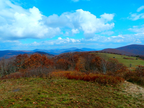
 Cole Mountain meadows by Mark Miller
Cow Camp Gap is a low spot between Bald Knob and Cole Mountain. Just below the gap is the Cow Camp Gap shelter that serves as a stopover for many through hikers on the Appalachian Trail. On Bald Mountain there is a small rock outcrop with a good view to the west. However, the summit is forest covered. Cole Mountain, on the other hand, is a huge open meadow with wonderful views in every direction. The climb from Cow Camp Gap to the summit of Cole Mountain features a long forgotten old rock fence. The summits of both Mount Pleasant and Pompey are capped by a layer of pre-Cambrian granite. Mount Pleasant has a short ridge running almost east to west with a rock outcrop offering a view of the Buffalo River valley and Virginia’s Piedmont region even farther to the east. In the fall clusters of red berries hanging from the limbs of the Mountain Ash surrounding the summit is a sight to behold. It is also a good location to watch the annual raptor migration as these big birds make their journey southward for the winter.
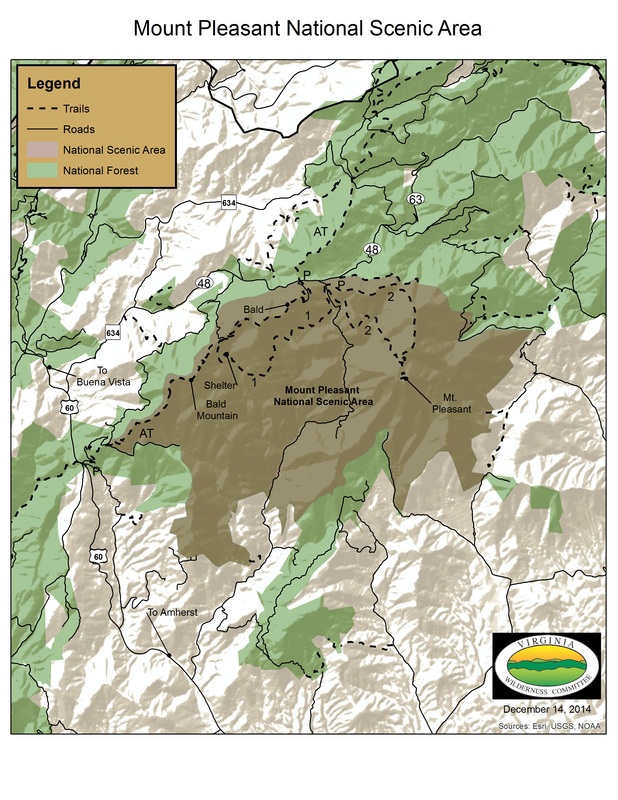
 Click on map for larger view
There are two wonderful loop hikes in the Mount Pleasant National Scenic Area.
1. The AT/Hotel Trail Loop is 7.5 miles long. This trail follow the AT through the bald on Cole Mountain before descending to Cow Camp Gap and the Cow Camp Gap Shelter. Here it contours along the mountain making several small stream crossings before entering an old clearing where an old cabin stood known as the Hotel. It was used by hunters and herders in times gone by. The trail continues on to Hog Camp Gap.
2. The Henry Lanum Loop is a 6.2 mile loop circles around and over the summit of Pompey Mountain beginning and ending at Hog Camp Gap. There is a short side trail (0.5 miles) to the summit of Mount Pleasant.
| Printable Map of Mt. Pleasant National Scenic Area.pdf | |
| File Size: | 1264 kb |
| File Type: | |
