
Wild Oak Trail from Camp Todd to Little Bald Knob
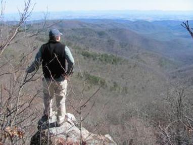
View to the east from Wild Oak Trail
Length: 6.0 miles out and back
Starting location: From Bridgewater, VA, travel 4.0 miles south on Rt. 42. Turn right onto Rt. 809 (becomes 747 Mossy Creek Rd). Go 3.4 miles to Mt. Solon and turn right onto Rt. 731, Natural Chimneys Rd. Travel 1.0 mile, turn left onto North River Rd. Go 3.6 miles to stop sign, turn right on Rt. 718 (Stokesville Rd). Go 1.0 mile, bear left on FDR 95 at the sign for the North River Multiple Use Area. Go 9.5 miles on FDR 95, following signs toward WV State Line. Trailhead is on the right, across the road from Camp Todd. (Note: if the water is high and the North River is difficult to cross, continue on FDR 95 another .5 mile; after crossing the bridge, pull into parking area on right to take the spur trail.)
Difficulty: difficult (steady climb, rocky in places)
Map (See attachment below)
Description: You have two options for the first ½ mile of this hike. The original white-blazed Wild Oak National Recreation Trail is located across from Camp Todd. A new spur trail was built in 2010 to avoid the North River crossing, and can be accessed by continuing on FDR 95 across the bridge, where the trailhead is on your right. (This new section of trail is not shown on the map.)
From Camp Todd: Across the road from the Camp Todd sign, follow white blazes to walk by a campsite and to the creek. Cross the North River and continue on trail uphill. After .3 miles, you will come to the convergence with the new spur trail coming up from your left. Continue straight ahead toward Little Bald Knob, or take the spur trail to the left for a short 1.5-mile loop.
From Spur Trail: Ascend up a couple switch-backs and over a ridge to a small stream crossing. You will soon come to the intersection with the original Wild Oak Trail converging from the right. Switchback to the left to continue up toward Little Bald Knob, or take the trail to the right to descend back down to the creek and Camp Todd, where you can walk ½ mile back to your car.
From the convergence of the spur trail and the Wild Oak Trail, you face a continuous climb up to Little Bald Knob. However, it is not too steep. You'll soon enter a glade of thick fetterbush and table mountain and pitch pine. After 1.0 mile, you will emerge from the pines into a beautiful grove of chestnut oak trees. Continue up the mountain another mile; at the top of a ridge, switch back to cross a saddle where you can enjoy a beautiful view across the valley. Continue another ½ mile to Little Bald Knob.
Trail is open to horses and bicycles.
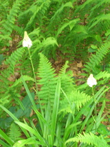
Fly poison is abundant on the summit of Little Bald Knob
|
Why we like it: This section of the Wild Oak National Recreation Trail offers tremendous views, especially when the leaves are off trees. Along the steady climb, enjoy views to the south of various peaks of Shenandoah Mountain and Ramsey's Draft Wilderness Area (Tearjacket Knob, Big Bald Knob). About ½ mile below Little Bald Knob there is a long view across the ridges and valley floor - on a clear day, the Blue Ridge mountains are visible. The forest quality is beautiful, pristine and typical for high-elevation GWNF, with lots of pitch pine and table mountain pine, pieris floribunda (fetterbush), and chestnut oak along the trail. The trail is well-marked and easy to navigate, yet typically quiet with wonderful opportunity for solitude.
|
|
Watch out for:
|
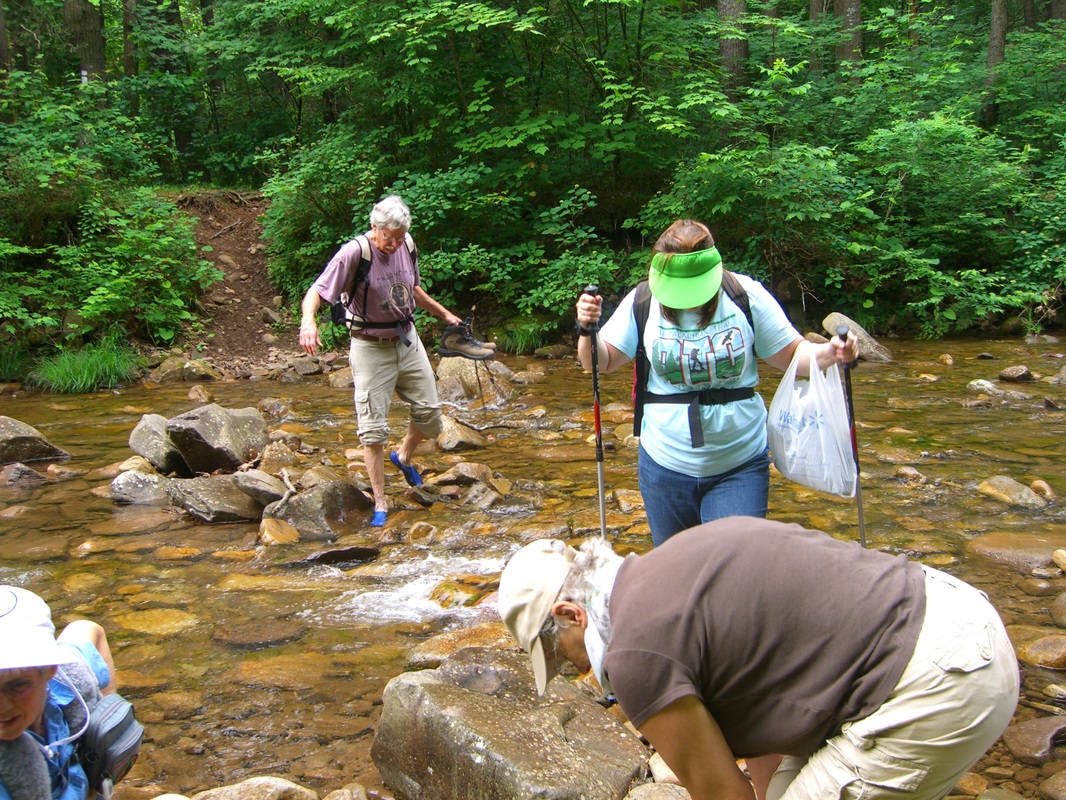
Crossing the North River can be trick if the water is high.
|
| Mapoflittlebaldknob.pdf |