Kelley Mountain - Big Levels Proposed National Scenic Area
Approximate size: 12,895 acres
Location: Augusta County, Pedlar Ranger District
Topos: Big Levels, Sherando, Stuarts Draft
The Kelley Mountain proposed National Scenic Area lies northeast of the St. Mary's Wilderness Area in the Pedlar Ranger District. At 12,895 acres, the area ranges in elevation from 1600' at the Coal Road to 3440' at the summit of Flint Mountain. The area is generally typical of the Blue Ridge province and consists of broadly sloping, steep-sided rocky ridges, drained by small steep-gradient freestone streams. An unusual feature is the Big Levels. This plateau averages 3000' and is a remnant of the Summit Peneplain dating before the Blue Ridge upthrust. It is almost perfectly flat in some areas and is densely vegetated with pin oak, post oak, chestnut oak, Virginia pine, mountain laurel, rhododendron, wild azalea, black gum, and an extensive growth of young American chestnut.
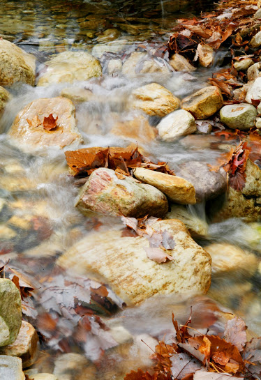
Wild turkey and whitetail deer are particularly abundant with a smaller population of black bear. There is a good population of timber rattlesnakes, a species that is rapidly being threatened throughout its range. All streams draining the area with the exception of Orebank Creek contain populations of native Eastern brook trout. Blueberries are in profuse abundance on the ridge slopes. Large to medium second growth timber, primarily yellow poplar, northern red oak, chestnut oak, white pine, hemlock, black gum, and hickory are present in the moist valley areas. The Virginia Division of Conservation and Recreation indicate a number of endangered or threatened species, and the area has a high priority for protection.
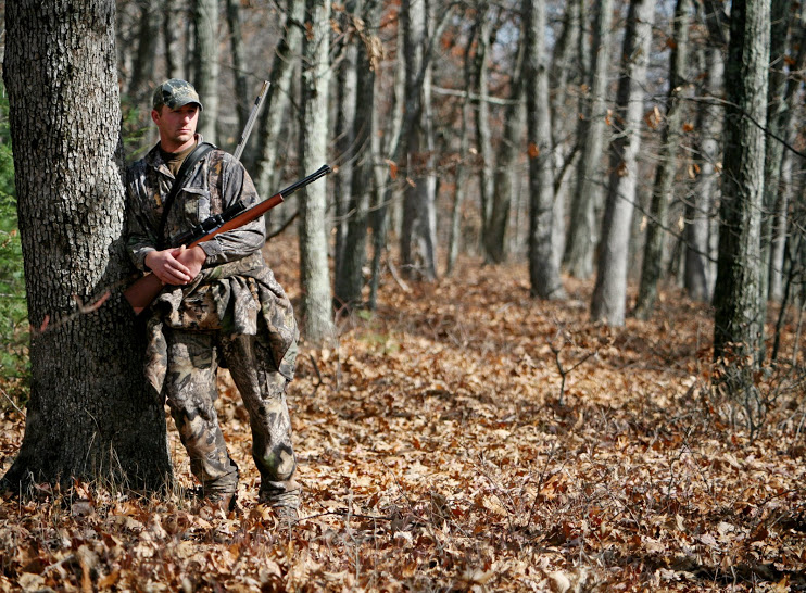
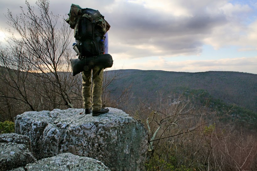
In the past, most of the area has been logged, and the mining of iron ore and manganese was also once a principal commercial use.Today the area is primarily managed for recreation and watershed protection. Recreational uses include hiking, fishing, camping, recreational vehicle use, mountain biking, and hunting. Hunting is particularly popular during deer season. Mountain biking is very popular in the area; local clubs from Charlottesville and Harrisonburg maintain many of the trails.
Its proximity to Sherando Lake and the Blue Ridge Parkway makes National Scenic Area designation appropriate. This status would protect the biological richness and beauty of this unique area while allowing mountain biking and vehicular access to continue.
Location: Augusta County, Pedlar Ranger District
Topos: Big Levels, Sherando, Stuarts Draft
The Kelley Mountain proposed National Scenic Area lies northeast of the St. Mary's Wilderness Area in the Pedlar Ranger District. At 12,895 acres, the area ranges in elevation from 1600' at the Coal Road to 3440' at the summit of Flint Mountain. The area is generally typical of the Blue Ridge province and consists of broadly sloping, steep-sided rocky ridges, drained by small steep-gradient freestone streams. An unusual feature is the Big Levels. This plateau averages 3000' and is a remnant of the Summit Peneplain dating before the Blue Ridge upthrust. It is almost perfectly flat in some areas and is densely vegetated with pin oak, post oak, chestnut oak, Virginia pine, mountain laurel, rhododendron, wild azalea, black gum, and an extensive growth of young American chestnut.
Wild turkey and whitetail deer are particularly abundant with a smaller population of black bear. There is a good population of timber rattlesnakes, a species that is rapidly being threatened throughout its range. All streams draining the area with the exception of Orebank Creek contain populations of native Eastern brook trout. Blueberries are in profuse abundance on the ridge slopes. Large to medium second growth timber, primarily yellow poplar, northern red oak, chestnut oak, white pine, hemlock, black gum, and hickory are present in the moist valley areas. The Virginia Division of Conservation and Recreation indicate a number of endangered or threatened species, and the area has a high priority for protection.
In the past, most of the area has been logged, and the mining of iron ore and manganese was also once a principal commercial use.Today the area is primarily managed for recreation and watershed protection. Recreational uses include hiking, fishing, camping, recreational vehicle use, mountain biking, and hunting. Hunting is particularly popular during deer season. Mountain biking is very popular in the area; local clubs from Charlottesville and Harrisonburg maintain many of the trails.
Its proximity to Sherando Lake and the Blue Ridge Parkway makes National Scenic Area designation appropriate. This status would protect the biological richness and beauty of this unique area while allowing mountain biking and vehicular access to continue.