James River Face Wilderness Additions
Approximate size:
James River Face Wilderness 8,907 acres
Powhatan Addition 843 acres Potential Old Growth: 261 acres
Piney Ridge Addition 1,183 acres Potential Old Growth: 0 acres
Total with Additions 10,933 acres
Location: Glenwood Ranger District
James River Face Wilderness 8,907 acres
Powhatan Addition 843 acres Potential Old Growth: 261 acres
Piney Ridge Addition 1,183 acres Potential Old Growth: 0 acres
Total with Additions 10,933 acres
Location: Glenwood Ranger District
Pine Ridge Addition

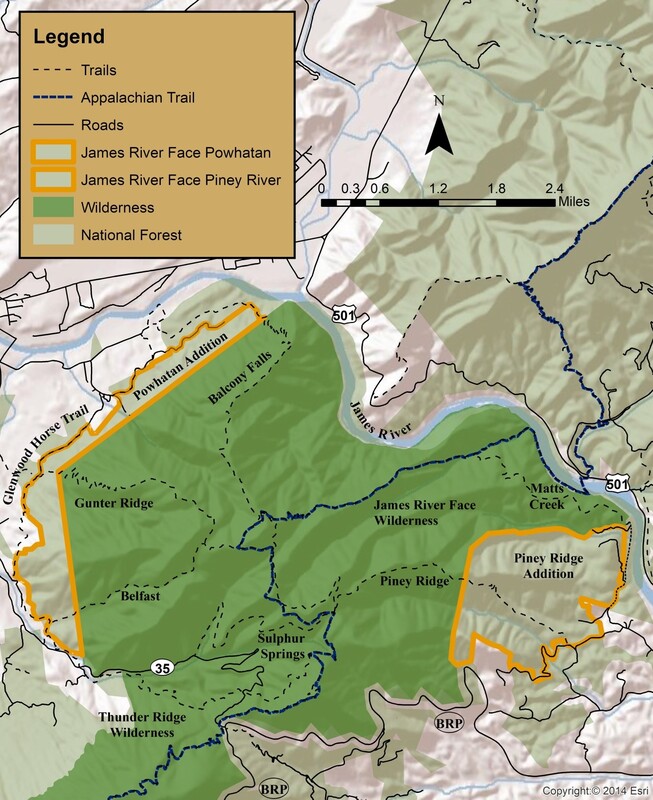
The 1,183 acre Piney Ridge addition is located on the eastern flank of the James River Face Wilderness. Piney Ridge is composed of mostly rich hardwood forests with an age range from sixty to nearly one hundred years old. It was recognized as a Roadless Areas and designated as a Wilderness Study Area in the Revised Management Plan for the Jefferson National Forest in 2004.
Snowy Creek and Peters Creek are both tributaries of the James River. Peters Creek begins in the Wilderness and flows out the southern end of the addition on its way to the James River. Peters Creek is a designated cold water stream. Snowy Creek runs adjacent to the northern boundary of the addition.
The Piney Ridge addition is mostly represented by a Dry Mesic Oak Community or the drier Dry Mesic Oak-Pine Community. There are 261 acres of potential old growth including such species as Chestnut oak, Scarlet oak, and assorted yellow pine within the boundary of the additions.
The area is managed primarily for Black bear and is popular during hunting season. The Piney Ridge Trail runs through the middle of the addition before entering the James River Face Wilderness. It terminates at the AT.
Access: Take US 501 to FDR 54. Continue on FDR 54 and turn right on FDR 54A. The trailhead for the Piney Ridge Trail is located behind the gate.
79°23'30.534"W 37°34'15.423"N
Powhatan Addition
The 843 acre Powhatan addition is named for the Boy Scout Camp that existed in the area at the turn of the 20th century. It was located on Elk Creek.
This addition encompasses the mostly western boundary of the James River Face Wilderness. It is bordered by the Glenwood Horse Trail. The Balcony Falls, Gunter Ridge and Belfast Trails each provide access to the addition and to the James River Face Wilderness.
Belfast Creek is a designated cold water stream and parallels the Belfast Trail. There is a small low-flow waterfall on the trail adjacent to the Devils Marbleyard in the Wilderness. Big Hellgate Creek also tumble down to the Powhatan addition from the James River Face Wilderness. Both are tributaries of Elk Creek. A nearly pure stand of White pine can be found within its boundary. Smaller groves of cove hardwoods are located in the watersheds of Big Hellgate Creek and Belfast Creek as well as several unnamed streams in addition. Otherwise, the addition is mostly represented by a Dry Mesic Oak Community.
This addition pushes the western boundary of the James River Face Wilderness to it logical maximum extension adjacent to the Glenwood Horse Trail.
Access: This addition can be accessed at several locations.
The Belfast Trail and Glenwood Horse Trail are accessed at the same point.
79°29'30.064"W 37°34'15.991"N
The Gunter Ridge Trail is accessed via the Glenwood Horse Trail.
79°29'35.808"W 37°35'45.448"N
Glenwood Horse Trail parking area.
79°28'49.027"W 37°36'27.554"N
The Balcony Falls Trail.
79°28'20.86"W 37°37'7.096"N
James River Face Wilderness

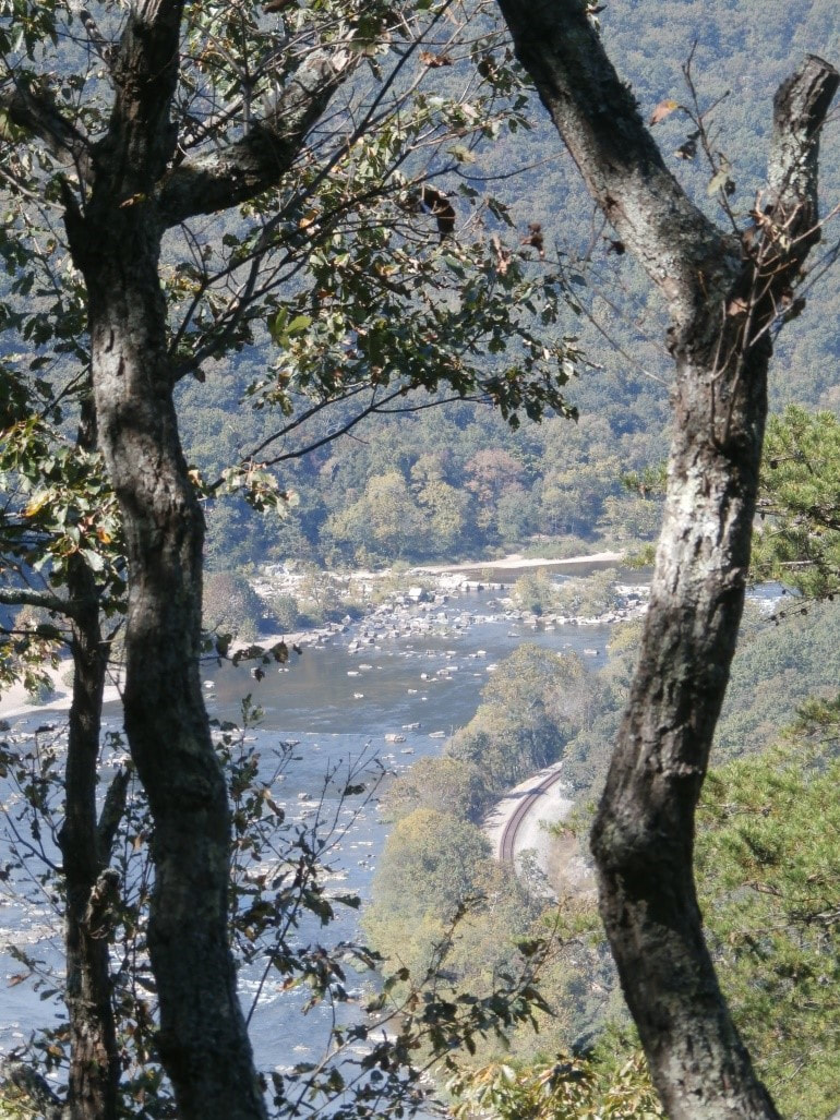
The James River Face Wilderness was established in 1975 as a part of the Eastern Wilderness Areas Act. It was the first Wilderness designated in Virginia. The Wilderness is bordered on its northwestern flank by the James River. This is where the James River cuts through the Blue Ridge Mountains creating a beautiful steep walled gorge. James River Face is the source of three designated cold water streams and due to its rugged topography, there are many small waterfalls.
Almost ten miles of the Appalachian Trail makes its way through the James River Face. The Matts Creek Shelter is located near the James River. Besides the AT, the James River Face Wilderness has nearly 18.5 miles of other trails all of which begin outside the Wilderness boundary. These trails combined with the AT make a series of loops for any hiking ability.
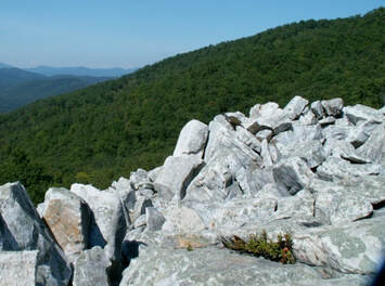
The Devils Marbleyard is a significant rock outcrop and boulder field of quartzite boulders. Some of which are the size of a dump truck.
The Wilderness includes a tremendous diversity of vegetation. About 800 species of plants have been identified here, representing a quarter of all the species recorded in Virginia. Three species of plants present in the Wilderness are listed as being extremely rare. Cove hardwoods dominate the moist sites, while northern Red oak, Chestnut oak, and yellow pine are the dominate trees throughout the rest of the Wilderness. Some of the driest areas include shale barrens. These barrens present a stark contrast to the rest of the Wilderness. The Old Growth Forest Network recently recognized 1620 acres along the Belfast Trail as an old growth forest much of which dates back to the 1880’s.
The James River Face Wilderness is the only Class 1 air quality site on the entire Jefferson National Forest.


