
Hardscrabble Knob Hike
Hardscrabble Knob
Length: 7 miles out and back
Starting location: From Bridgewater, VA, travel 4.0 miles south on Rt. 42. Turn right onto Rt. 809 (becomes 747 Mossy Creek Rd). Go 3.4 miles to Mt. Solon and turn right onto Rt. 731, Natural Chimneys Rd. Travel 1.0 mile, turn left onto North River Rd. Go 3.6 miles to stop sign, turn right on Rt. 718 (Stokesville Rd). Go 1.0 mile, bear left on FDR 95 at the sign for the North River Multiple Use Area. Go 9.5 miles on FDR 95, following signs toward WV State Line. Park at Camp Todd, on your left. Look for the trailhead leading up the ridge on the left side of the parking area.
Map (See attachment below)
Difficulty: moderate (steady climb, rocky in places)
Description: This hike starts out with a long, steady climb up Springhouse Ridge on a segment of the Wild Oak National Recreation Trail. You will see a few white blazes, but only at the bottom and near the top of the climb. The trail climbs through the gorge and makes several small switchbacks before beginning to level off at 1.2 miles. At 1.6 miles, arrive at the intersection of Bald Ridge Trail (to the left), and Tearjacket Trail to the right (this trail is also called Hiner Springs Trail). Turn right on Tearjacket and pass a nice campsite in 50 yards. The trail then descends through the gap, and rises back to Hiner Spring, approximately 3 miles from the start.
At Hiner Spring you will intersect Ramsey's Draft Trail. Take the trail to the right, crossing the wet spring area and gently climbing a short slope up to a gap where a sign will point left toward Hardscrabble Knob. Ascend on the Hardscrabble Knob spur trail .4 mile to the summit.
Backtrack and return on same route.
Why we like it: The initial climb is arduous, but well worth the effort, with nice winter views of Big Bald Knob as you ascend the ridge. Notice the change in vegetation as you climb, as mountain fetterbush (pieris floribunda) and eastern hemlock become more abundant. It's refreshing to see high-elevation hemlock trees that appear healthy and strong, unaffected (as of 2011) by the hemlock woolly adelgid. Hiner Spring (head of Ramsey's Draft) offers water most of the year, and is a place of quiet serenity as the water bubbles from the ground in the midst of cushion moss, ferns, and an open oak/birch/maple forest. The campsites here are among the best.
|
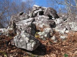
At Hardscrabble Knob, the old cabin and fire tower remind us of times past; the red spruce trees were most likely planted at the time this peak was established as a fire-lookout site.
A number of unusual plants grow amongst the sandstone rock outcrop, but you can scramble to the highest point for winter views of the wilderness area and Bald Ridge to the southeast. There are campsites at Hardscrabble Knob, but no water. Watch out for:
|
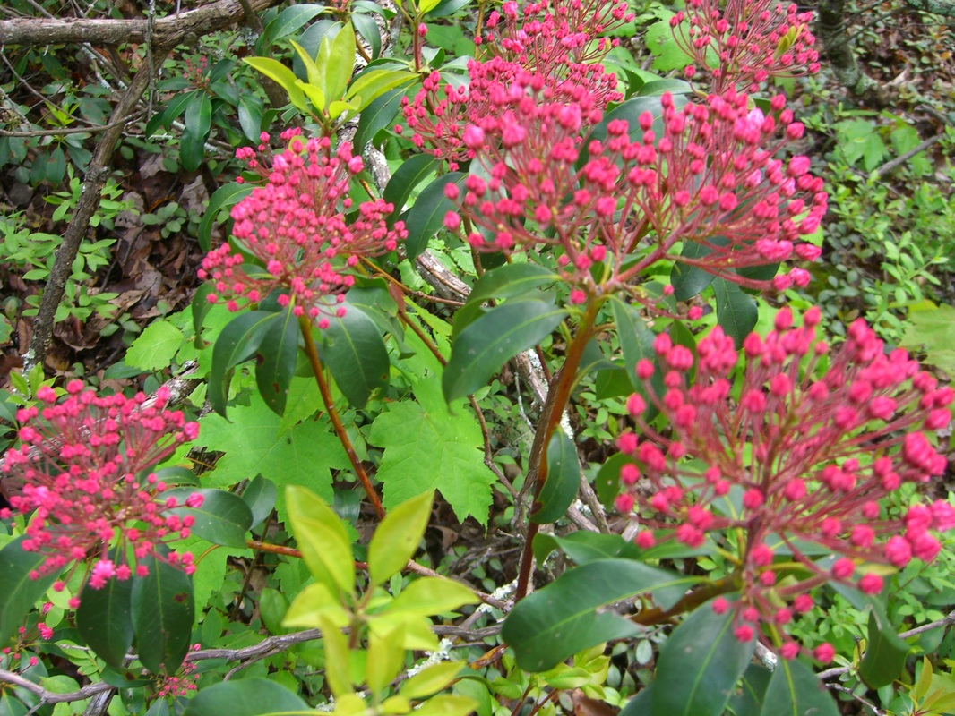
Mountain Laurel ready to bloom
|
| Mapofhardscrabbleknob.pdf |